
Carbondale ZIP Code Coverage
Three ZIPs form the city-associated starting set for Carbondale postal research: 62901, 62902, and 62903. Census geography associates the city with those ZCTAs, while a USPS label list groups 62901 through 62903 under Carbondale, Illinois 62901. Neither source replaces an exact USPS address result. The distinctions below are intentionally modest because the unattended research did not expose USPS category labels for ordinary delivery, PO boxes, or unique assignments.
| ZIP Code | Areas Covered | Post Office | Notes |
|---|---|---|---|
| 62901 | Central-city and downtown association | Downtown Carbondale office | Verify exact route and PO-box status with USPS |
| 62902 | Carbondale city/ZCTA association | Carbondale label family | USPS assignment category was not exposed |
| 62903 | Carbondale city/ZCTA association | Carbondale label family | Postal geography is not the legal city boundary |
USPS also lists 62918, 62924, and 62966 within the service network of its Carbondale sorting and delivery center. That is an operational link, not a finding that every address in those codes has a Carbondale city label. Check the full address before assigning a person or parcel to Carbondale.
Verify a Carbondale ZIP With USPS
The USPS ZIP Code Lookup is the authority for a current mailing assignment. Its modes answer different questions: an exact address can return a mailing code, city and state can return associated ZIPs, and a ZIP can return associated city labels. Save the result and lookup date because postal data can change.
| USPS mode | Fields | Best use |
|---|---|---|
| By address | Street, city, state, or street and ZIP | Confirm one deliverable address |
| By city/state | City and state | Review ZIPs associated with Carbondale |
| By ZIP | Five-digit ZIP | Check associated city labels |
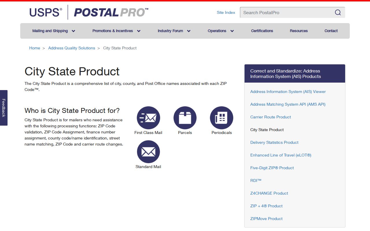
The successful PostalPro capture below comes from the USPS City State Product page. It represents an official data route for city and ZIP relationships, not a street-level resident list.
Carbondale ZIP Service Points
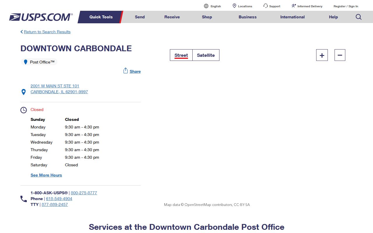
The Downtown Carbondale Post Office is at 2001 West Main Street, Suite 101, with the postal form Carbondale, IL 62901-9997. The inspected listing gives retail hours of 9:30 a.m. to 4:30 p.m. Monday through Friday, closed Saturday and Sunday, and phone 618-549-4904. The Southern Illinois Sorting and Delivery Center is at 1301 East Main Street.
The official post-office listing shown below is useful when a web result is unclear or a question needs a phone or counter follow-up.
Ask USPS about the postal assignment itself. City Hall, the assessor, or a census profile cannot settle which label a carrier uses for a specific address.
Search Carbondale Records by ZIP
A postal search narrows geography, but Carbondale portals use ZIP in different ways. The county assessor has no dedicated ZIP input in the inspected form. It accepts house-number bounds, street, and city, then the GIS card reports SiteCityStateZip and separate mailing fields. The Illinois voter tool requires a five-digit ZIP as part of an exact person/address match. It is not an open browse by ZIP.
- Normalize the number, directional, street suffix, unit or lot, city, state, and any supplied ZIP.
- Run the full address through USPS and save its returned label and lookup date.
- Search the Jackson County assessor by house range, street, and city. Open the parcel in GIS.
- Compare GIS SiteCityStateZip with OwnerAddress and MailToAddress. Do not turn a tax-mail destination into a residence claim.
- For a known voter, use the exact five-digit ZIP and the street name selected by the official form.
- Identify the layer in the notes: USPS ZIP, census ZCTA, city limit, township, planning area, or parcel situs.
Once the postal area is reduced to a named road, the Carbondale street directory supplies the parcel and deed walkthrough. That handoff avoids treating all addresses in one ZIP as a single block or neighborhood.
Carbondale ZIP Fields Differ
The same five digits play different roles across official systems. Read the form before assuming that ZIP is a broad search filter.
| Official system | ZIP behavior | Meaning |
|---|---|---|
| Jackson wEdge | No ZIP input observed; search street, city, range | Assessment query, followed by GIS output |
| Jackson BHAMaps | SiteCityStateZip and mail-to are output fields | Physical parcel and tax mailing data remain separate |
| Illinois voter lookup | Required five digits, maximum five characters | Validates a known person and address |
| ISP statutory registry | Optional ZIP with name, city, county, and status | Limited to that registry's legal scope |
| Illinois I-Cash | Optional ZIP; name fields required | Narrows an unclaimed-property name search |
| USPS lookup | Address, city/state, and ZIP modes | Current postal authority |
A missed result may come from an out-of-town tax mailing ZIP, a registration address format, an omitted ZIP in a deed, or a historical legal description. Change one field at a time and retain the rejected format in the research log.
Carbondale ZIPs Versus City Limits
A ZIP is designed for mail delivery, not municipal government. A census ZCTA approximates ZIP geography for statistics. Carbondale's legal boundary comes from annexations and city records, Jackson County parcels carry municipality and township fields, and the Comprehensive Plan names planning areas. These layers overlap without being interchangeable.
The city's named Northeast, Northwest, Southwest, Southeast, and Western Boundary planning areas are not postal zones. The Arbor District has its own association boundary. A voter precinct, Neighborhood Watch block, assessor township, or parcel line adds still another geography. State which one a claim uses.
- ZIP
- A five-digit USPS delivery area, not a city boundary.
- ZIP+4
- A more precise postal code that can identify a delivery segment within the five-digit area.
- PO-box ZIP
- A ZIP assignment used for post-office boxes rather than ordinary street delivery.
- Unique ZIP
- A code assigned to one organization or very high-volume recipient.
- Carrier route
- A group of delivery points served in a carrier's route sequence.
Carbondale ZIPs on an Older Grid
Carbondale's original town was platted in 1852 and grew around the railroad after 1854. Code books from 1874, 1905, and 1929 preserve older rules and map context. Development Management later handled annexations, subdivisions, and plats. A nineteenth-century lot or road description cannot be forced into a modern ZIP without tracing those changes.
Save the legal street name, directional, number, unit, current USPS label, ZIP+4 when available, PIN, and every historic alias. The 1929 map's section descriptions can help place a tract that predates the current house number. Plats and deed legal descriptions may work when postal terms do not.
Carbondale's 2025 honorary street signs offer a clear caution. Elbert Simon Sr. Way and Kenneth “Kent” Mason Way are honorary labels, and the city says they do not change official addresses. They belong in an alias field, not in USPS input.
Carbondale ZCTA and USPS Evidence
The Census Carbondale profile associates the city with ZCTAs 62901, 62902, and 62903. A ZCTA is a statistical approximation built for census reporting. It can describe an area in aggregate but does not decide the proper mailing label for a house.
The USPS DMM label list groups 62901 through 62903 with Carbondale, and the service-center notice adds three regional codes to the Carbondale facility's network. Read those as two different findings. One concerns label grouping; the other concerns postal operations. Neither proves that a named person lives within the city's legal line.
Boundary check. Use USPS for the mailing code, county GIS for parcel situs, and city annexation files for municipal status.
Carbondale ZIP Research Beyond Portals
Online tools do not settle every address. Call the Downtown Carbondale Post Office for current postal questions. City Hall and Development Management handle street-name, plat, annexation, and boundary files. The Jackson County Assessment Office can help with PIN and parcel geography, while the Clerk & Recorder handles deeds and plats.
For older street forms, use Carbondale Public Library, JCHS, SIU Special Collections, and IRAD. Directories, code books, newspapers, Sanborn maps, and plats can bridge a pre-ZIP address to the present street. A narrow Illinois FOIA request may obtain non-exempt city map or annexation records, but postal assignment remains under USPS control.
Note: The best fallback names one address, a date range, and the exact map, plat, or municipal record sought.
Limits on Carbondale ZIP Lookup
A postal directory is not a resident roll. The Illinois voter tool checks a supplied name and address through required fields; it does not offer unrestricted browsing of everyone in a postal area. Registration data is also subject to disclosure limits, redactions, and anti-commercial-use rules. Parcel data identifies an assessed owner and tax correspondence, not all occupants.
Protected addresses must stay protected. Illinois's Address Confidentiality Program gives eligible survivors a substitute-address process, and the state cautions that real-property records may not be fully hidden. Do not combine public sources to expose a protected location or private household.
Lawful use. Use ZIP and address records for lawful personal research only, never to stalk, harass, threaten, or harm another person.